
Baykar Teknoloji Case Study
UX/UI Design
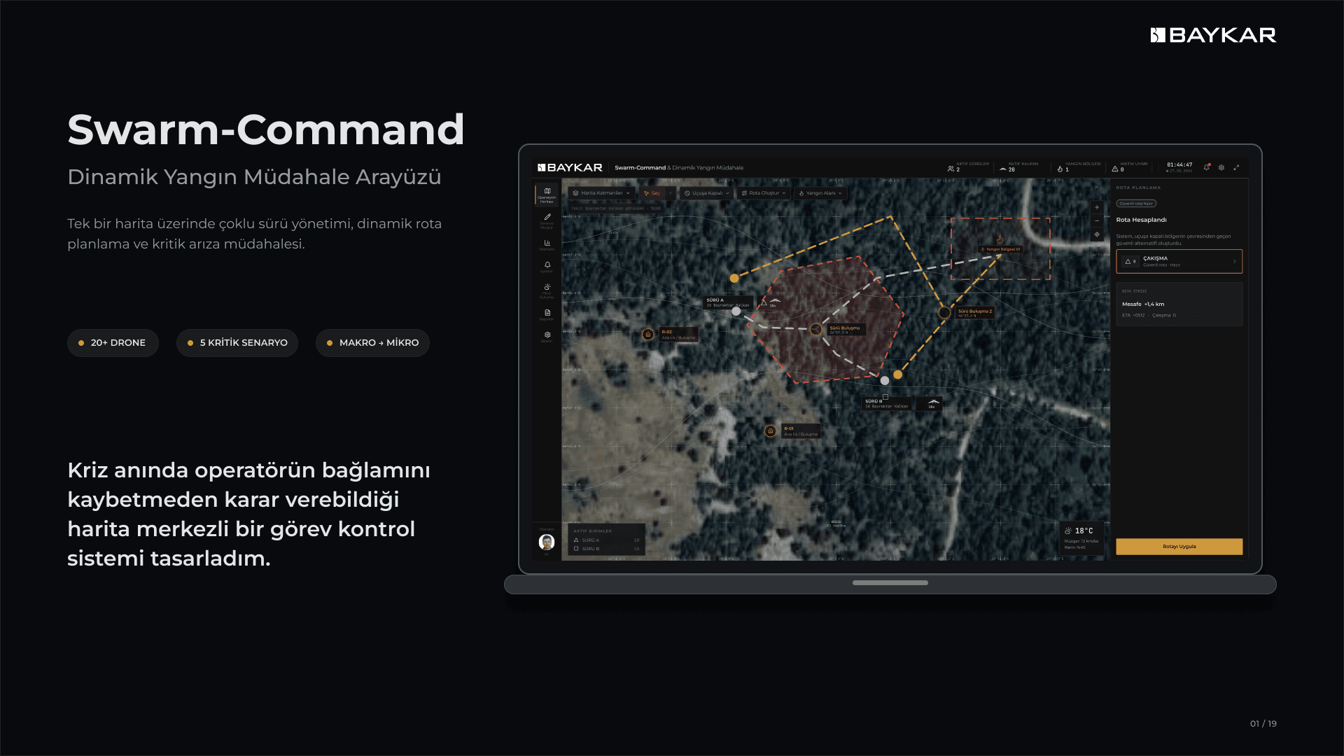
A map-centered swarm-command interface designed to help an operator manage 20+ emergency-response drones, dynamic routes, and critical failures without losing operational context.
Designing a map-centered swarm-command system that keeps complex emergency operations understandable from multi-drone coordination to route conflicts, micro-level failures, and safe return®.
Framing a Complex Emergency Operation Around Situational Awareness
Swarm-Command began as an exploration of how a single operator could coordinate more than twenty emergency-response drones during a dynamic wildfire operation. The challenge was not simply to place aircraft on a map. The operator needed to monitor two active swarms, understand each unit’s health and mission, respond to changing fire zones, evaluate newly calculated routes, and intervene when an individual drone developed a critical fault—all while preserving a clear picture of the wider operation.
I framed the central design objective as maintaining situational awareness while the crisis became more complex. Four requirements shaped the work: the location, mission, and health of every unit had to remain visible; operators needed to form and modify groups quickly through lasso and rectangular selection; the system had to prevent errors by summarizing targets and consequences before critical commands; and the interface needed to support movement from swarm-level monitoring to a single motor failure without removing the operator from the shared map context.
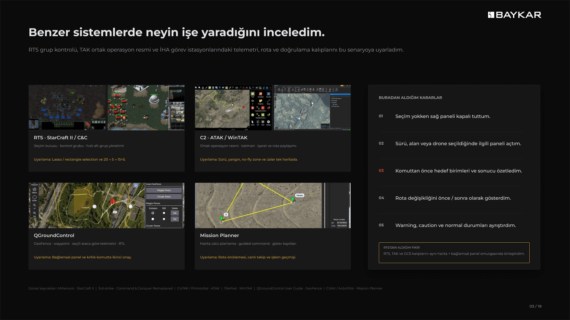
To ground the interaction model, I reviewed patterns from real-time strategy interfaces, TAK-based common operating pictures, and established ground-control tools such as QGroundControl and Mission Planner. RTS systems informed fast group selection and control; tactical mapping products demonstrated how layers, markers, and routes can coexist in a common operational picture; and ground-control interfaces provided references for telemetry, geofencing, route planning, return-to-launch, and command confirmation. I translated these references into a rule set for this specific scenario rather than copying any one product.
The resulting principles were intentionally simple: keep the contextual side panel closed until an object is selected; open only the information and actions relevant to the selected swarm, area, or drone; summarize the target units and expected result before issuing a command; show route changes as a visible before-and-after comparison; and separate normal, caution, and warning states so urgency could be understood without reading every label. Because direct access to operational users was not available at this stage, I created a provisional operator profile from the brief’s tasks and used it as a working hypothesis rather than presenting it as validated research.
Turning Five Critical Scenarios into One Coherent Interaction Model
I structured the product around one persistent operational map and a contextual right panel. The main navigation gives continuous access to the operation map, scenario creation, telemetry, alerts, weather, reports, and system settings. Map tools handle layers, multi-selection, no-fly-zone drawing, and route planning. The right panel changes according to the current selection, while shared operation data—mission, unit, route, alert, operator, and environmental information—remains available across the experience.
The first scenario covers takeoff and swarm merging: two groups of ten drones become a coordinated group of twenty while their origin, route, timing, and merge status remain visible. The second introduces a no-fly zone that blocks the active route. Rather than replacing the existing path silently, the system calculates a safe alternative, displays the conflict and the proposed route together, communicates distance and estimated-time changes, and asks the operator to approve the result before applying it.
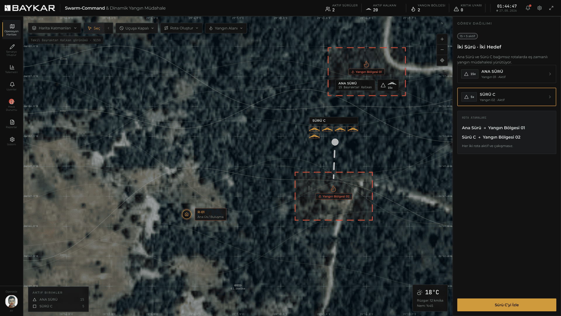
The third scenario introduces dynamic task division. The operator selects five drones from the active twenty-unit swarm and redirects them toward a newly detected fire while the remaining fifteen continue the original mission. Selection summaries, capacity information, visible group labels, and route previews make the consequences of the split explicit. This keeps the parent swarm understandable and prevents the newly created group from becoming disconnected from the wider operation.
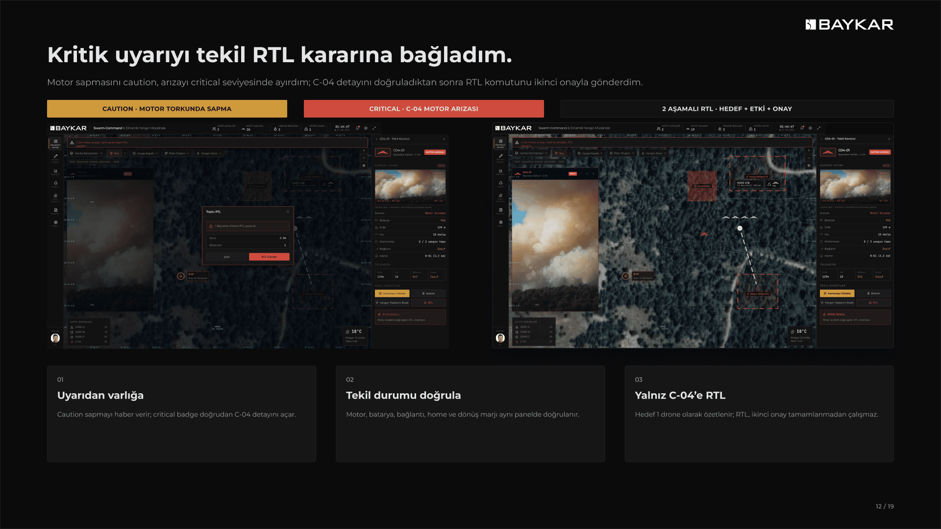
The fourth scenario moves from macro coordination to micro intervention when drone C-04 reports a motor fault. The interface highlights the affected unit, provides camera and telemetry detail, separates the single drone from the swarm context, and guides the operator through a return-to-launch decision with an explicit confirmation step. The key interaction decision was to resolve the failure at unit level without interrupting the mission of the remaining swarm.
The final scenario closes the operational loop through payload release and return to base. The operator can verify selected aircraft, review ammunition or payload state, monitor the return route, and complete the mission without leaving the shared map. Across all five scenarios, I documented the operator action, system response, decision point, successful outcome, and recovery path for an error state so that the experience behaved as one product rather than five unrelated screens.
Building the Interface System and Validating the Operational Logic
Role / Ownership
Product & UX/UI Designer · Research, Interaction Design, Design System & Prototype
Scope / Output
20+ Drones · 5 Critical Scenarios · High-Fidelity Interactive Prototype